MAPIHA is a comprehensive tool for creating and managing interactive maps with extensive features for marker management, geolocation, and data visualization. It is ideal for businesses and individuals looking to enhance their geographic presentations and provide detailed, interactive maps to their users.
About the Project
MAPIHA is a powerful and user-friendly application designed to help users create interactive maps with various markers and geolocation features. It provides a comprehensive interface for managing maps, markers, connections, geometries, and more. The application is suitable for businesses and individuals who need to display locations, routes, and spatial data on a map in an organized and visually appealing manner.
Date
15 May 2024
Client Name
MAPIHA
Key Features:
Dashboard Overview:
Provides a summary of the maps, markers, reviews, and total visitors.
Displays key statistics like the number of maps created, total markers, user reviews, and visitor count.
Maps Management:
List Maps: Manage and view all created maps.
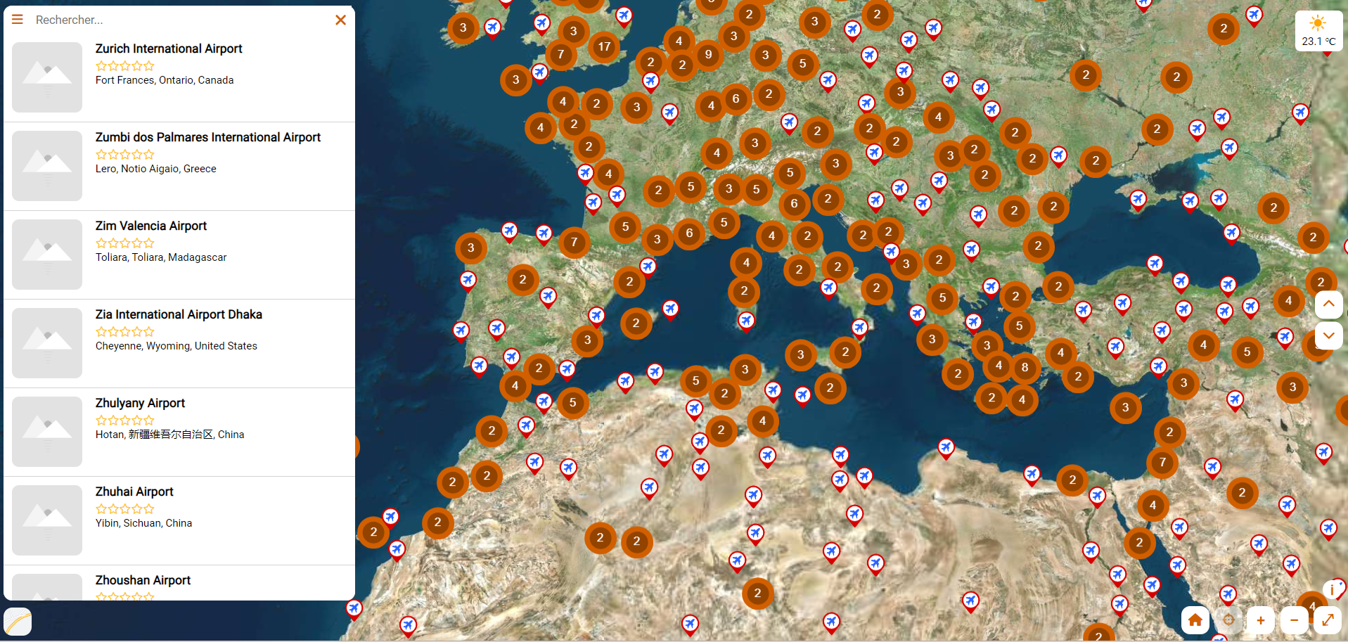
Markers: Add, edit, and delete markers on the maps. Markers can be customized with different icons and information.
Connections: Create and manage connections between different markers to show routes or relationships.
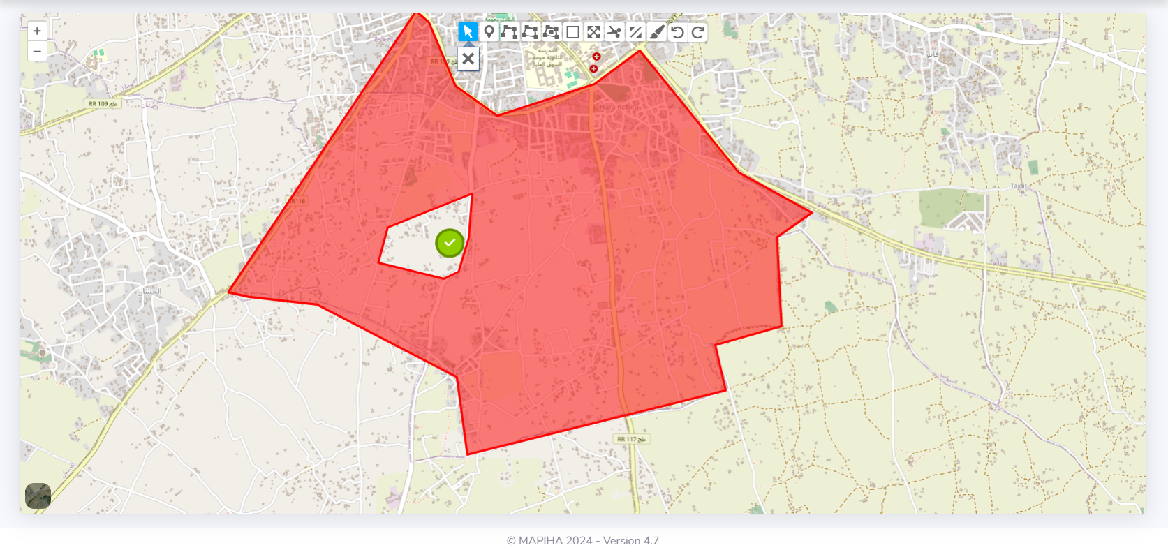
Geometries: Define and manage geometrical shapes like polygons, circles, and lines on the maps.
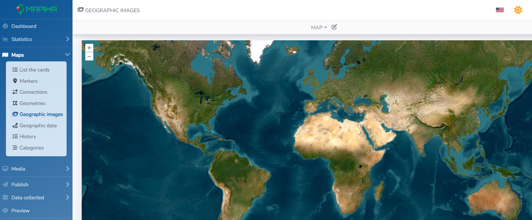
Geo Images: Attach images to specific locations or markers for better visualization.
Geo Data: Manage and analyze geospatial data associated with the maps.
Statistics and Visitors:
Provides detailed statistics about the number of visitors to each map.
Shows the performance of individual maps in terms of visitor count and engagement.
Media Management:
Upload and manage media files that can be linked to markers or used in maps.
Publishing and Preview:
Easily publish maps and preview how they will look and function before making them live.
Options to configure and customize the published maps.
User Management and Settings:
Manage user accounts and permissions.
Configure application settings to customize the functionality and appearance of the maps.
Upgrade and Support:
Options to upgrade the application for more features.
Access to support and documentation for assistance.
Map Features:
Interactive Map Display:
A visually appealing map interface with various customization options.
Ability to search and filter locations on the map.
Marker Customization:
Add new markers with custom icons and information.
Each marker can display detailed information such as name, address, and images.
Routes and Connections:
Visualize connections and routes between different markers.
Useful for displaying paths, travel routes, or relationships between locations.
Geometrical Shapes:
Draw and manage geometrical shapes on the map.
Helps in highlighting specific areas or boundaries.
Map Controls:
Various control options like zoom, pan, and layer selection.
Ability to toggle between different map views and layers.